|
Dundee |
|
| Clepington Road - Maryfield to Fairmuir - the Route of the Stouries | |
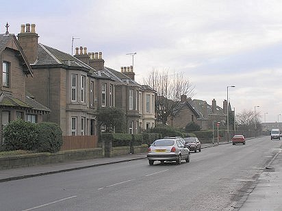
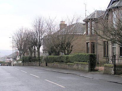
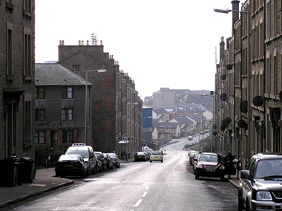
| Clepington Road is one of the city's longest streets and it was along Clepington Road between Maryfield (Forfar Road) and Fairmuir (Strathmartine Road) that the first trolleybus service in the UK operated briefly before the First World War. At that time Clepington Road was unmetalled and the service was referred to as the Stoories. | |
 |
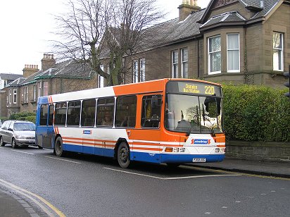 |
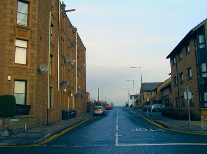
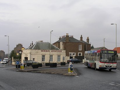
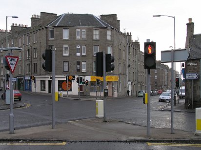
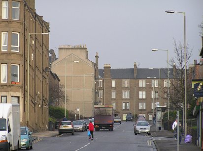
| The trolleybus service was intended to connect the tram service which terminated at Maryfield with the Downfield tram service which crossed Clepington Road at Fairmuir. Traffic lights at Clepington Road-Forfar Road (left) today mark what was the eastern terminus for the Stoories. A Strathtay service from Forfar (right) pauses at the same traffic lights, a few hundred metres south of the Maryfield tram terminus. PHOTOs - Malcolm McCrow | |
 |
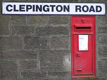 |
| Just south of the crossroads is the Maryfield Tram Depot (left), but cars have replaced the trams in this 2006 photograph. The Edward VII mailbox (above) also survives on a wall in Clepington Road near the traffic lights - PHOTOs Malcolm McCrow | |
 |
 |
| Clepington Road looking towards Mains Loan and North Court Street (left). Forfar Road north of Clepington Road (right) where the single track tram line terminated - PHOTOs Malcolm McCrow | |
 |
 |
| The top of Mains Loan (above) with the gap in the wall which accommodated a police box until the early sixties. The taxi office (above) is a surviving railway building which once formed part of Maryfield goods yard - PHOTOs Malcolm McCrow | |
 |
 |
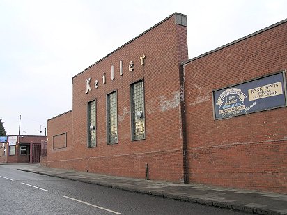
| Keiller's factory in Mains Loan (above) was north of the main Maryfield goods yard but had rail access to it. In 2006 Keiller is long since gone, but traces of the rail link remain (right) - PHOTOs Malcolm McCrow | |
 |
 |
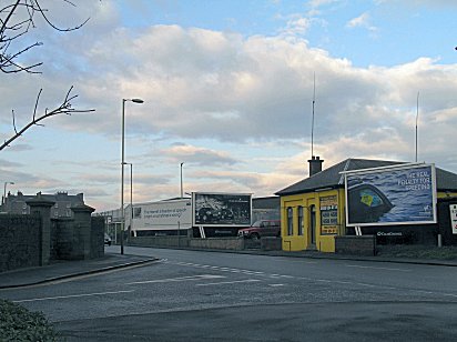
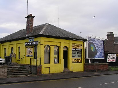
| The Maryfield goods yard was hidden behind billboards which have been replaced with a fence (left). Behind the wall (right) was Maryfield Hospital. But there was also another building - the Dundee School Meals Service kitchens. The grey patches on the wall indicate the former entrance and exit to the kitchens which closed in the late seventies - PHOTOs Malcolm McCrow | |
 |
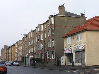 |
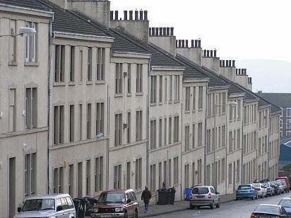
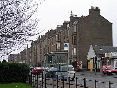
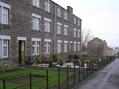
| Tenements line the north side of Clepington Road between Court Street North and Arklay Street (left). Joe Ianetta had an ice cream parlour while his sister Mary ran a fish and chip shop in the cream building (right) - PHOTOs Malcolm McCrow | |
 |
 |
| Distinctive brickwork on flats in Clepington Road (left) and Flemming Gardens (right) PHOTOs Malcolm McCrow | |
 |
.JPG) |
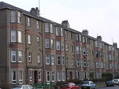
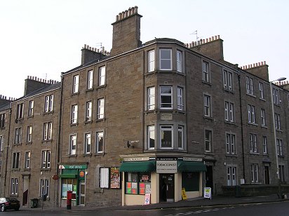
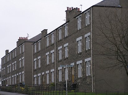
| Typical Dundee tenements - Balgray Place, built in the late 19th Century - PHOTOs Malcolm McCrow | |
 |
 |
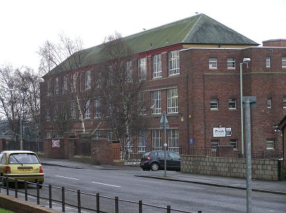
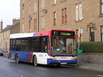
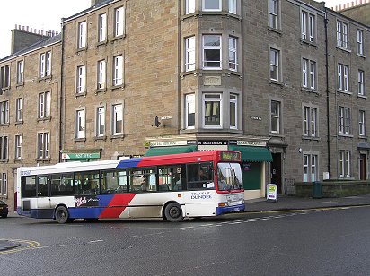
| Still the same route number after nearly 40 years - a Travel Dundee bus in Clepington Road on the No 7 Circular route (left). Similar in architecture to Stobswell Boys' School, St Michael's School (right) in Graham Street has also become part of Dundee College - PHOTOs Malcolm McCrow | |
 |
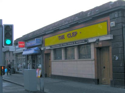 |
| For over 60 years the Clep's facade has remained unchanged - PHOTOs Malcolm McCrow | |
 |
 |
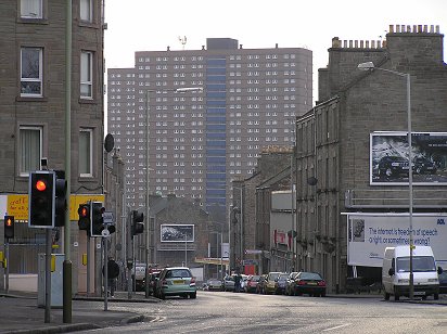
| Graham Street sloping up to where a bridge crossed over the railway branch line from Fairmuir to Maryfield (left). The filled-in cutting looking west from where the bridge used to be (right) - PHOTOs Malcolm McCrow | |
.JPG) |
.JPG) |
|
Graham Street and houses on the site of Gray's Garage which became the Coca Cola Bottling plant in the late1950s. A Plaxton single decker on route 21 has replaced Dundee Corporation's double decker on route 12 - PHOTOs Malcolm McCrow |
|
 |
 |
|
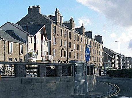
To the north of the two football stadiums is Flemming Gardens, commenced in 1929 - PHOTOs Malcolm McCrow |
|
 |
 |
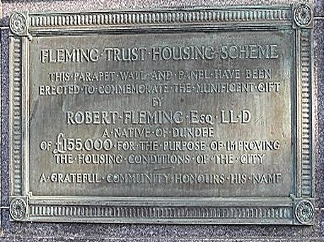
| An ornamental parapet was built at Hindmarsh on Clepington Road to commemorate Flemming's "magnificent gift". By today's standards the wording on the plaque is somewhat patronising - PHOTOs Malcolm McCrow | |
 |
 |
| Across from the parapet was Beatties' Bakery. Like the former Grey's Garage which became the Coca Cola bottling plant in the 1960s, it too has been swept away to make room for flats - PHOTOs Malcolm McCrow | |
|
|
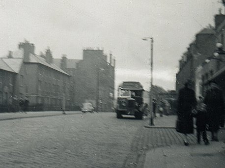
A
Number 2 bus in August 1957seen in Clepington Road as it heads for Mains Loan (having
come via William
Street) . Shortly after that month the single deck busses on this route were replaced by
ex-London Transport RTs. Although the picture is of poor quality, Clepington Road can be seen virtually devoid of traffic, save for the parked Morris Minor. Apart from the traffic congestion today, little has changed in this scene in fifty years. The photograph was taken with a Brownie box camera. - PHOTO Malcolm McCrow |
 |
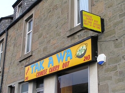 |
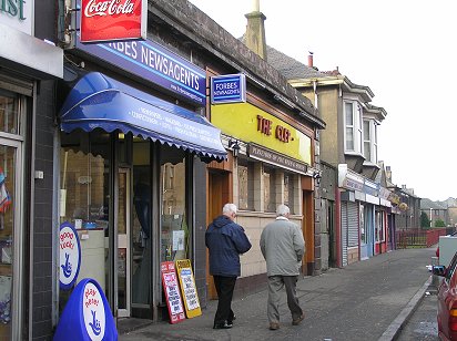
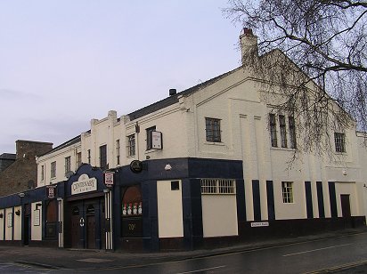
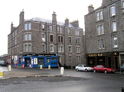
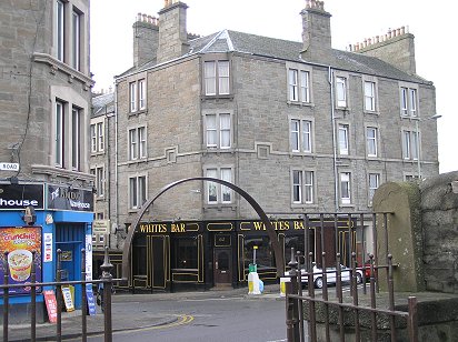
| Signs of change - once the Ambassadeur, now the Centenary Bar (left). Chinese Dundee or Dundee Chinese? (right) PHOTOs Malcolm McCrow | |
 |
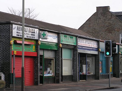 |
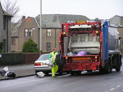
| Trash truck does its rounds in Clepington Road (left). Shops in Clepington Road at the top of Provost Road (right) - PHOTOs Malcolm McCrow | |
 |
 |
| Provost Road (above) leading down to Dens Road past Dens Park - the blue structure in the centre of the picture. Trams used to line the spur at the foot of Provost Road during Saturday afternoon football matches. Provost Road at its junction with Clepington Road (right) - PHOTOs Malcolm McCrow | |
 |
 |
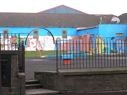
| Black Mail? A disused post box outside a deserted children's playground at top of Provost Road (left). Top of Provost Road (right) PHOTOs Malcolm McCrow | |
 |
 |
| Once the home of Dundee Savings Bank at the top of Caird Avenue (left). Coldside Library at the foot of Caird Avenue (right) - PHOTOs Malcolm McCrow | |
 |
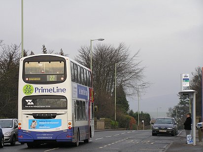 |
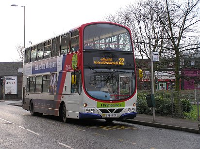
| Wright Gemini Eclipse on PrimeLine 22 service to Downfield has crossed Clepington Road at what once was the Fairmuir goods yard (left) and proceeds across what was the bridge over the Fairmuir-Maryfield branch (right). The branch closed in the mid sixties - PHOTOs Malcolm McCrow | |
 |
 |
| Fairmuir at the crossroads of Clepington Road and Strathmartine Road, the western terminus for the Stoories - PHOTOs Malcolm McCrow | |
| Arklay Street and Court Street | |
| Of the two streets, Arklay Street is the older and the longer, connecting Dens Road with Clepington Road. Court Street was only extended to Clepington Road when houses were built in the fields to the north of Clepington School (now demolished) in the 1930s. | |
 |
 |
| Arklay Street - in the vicinity of Tannadice Street (left). St Jameses Church has been replaced by flats (right). Dundee's football stadia, DFC's Dens Park (left) and Dundee United's Tannadice (right) can be seen in the background - PHOTOs Malcolm McCrow | |
 |
 |
| The long climb up Arklay Street from Dens Road to Clepington Road - PHOTOs Malcolm McCrow | |
 |
 |
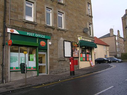
| Masterton's and Arklay Street Post Office - virtually unchanged over 50 years - save for the modern Travel Dundee bus - PHOTOs Malcolm McCrow | |
|
|
|
|
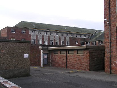
The telephoto lens amplifies the steepness of the grade in Court Street (left) where concrete flats lead down to Dundonald Street. Stobswell Boys' School in Melrose Terrace has survived to become part of the Dundee College complex (right) PHOTOs Malcolm McCrow |
|
 |
 |
| North Court Street between Clepington Road and Arklay Terrace - PHOTOs Malcolm McCrow | |
| Maryfield | |
 |
 |
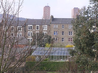
| Dundee Law and new houses on the site of former Clepington School | Clepington Road PHOTOs Malcolm McCrow |
 |
 |
| Court Street from the grounds of the Dundee International Sports Complex | PHOTOs Malcolm McCrow |
 |
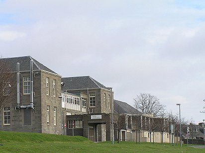 |
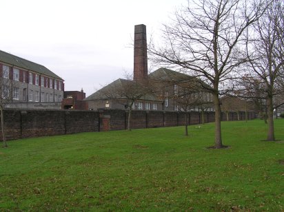
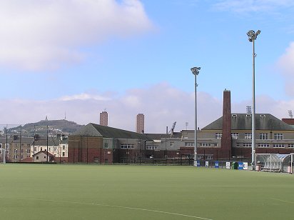
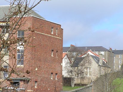
| Buildings which once formed part of Maryfield Hospital | PHOTOs Malcolm McCrow |
 |
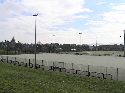 |
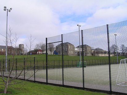
| Games pitches at Dundee International Sports Complex | PHOTOs Malcolm McCrow |
 |
 |
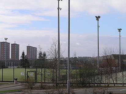
| Multis from Dundee City Council's DISC | PHOTOs Malcolm McCrow |
 |
 |
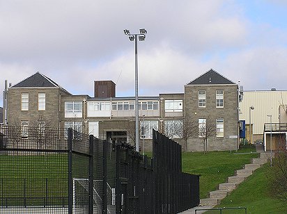
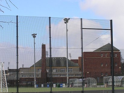
| Former Stobswell Boys' School viewed through the nets of the DISC | All that remains of the former Clepington School - the janitor's house |